A vessel gives you a latitude and longitude. Or you see it in the vessel details log. But where is it?
You can use Google maps to pinpoint a location.
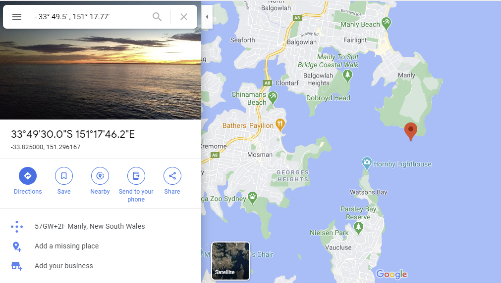
- If given the latitude and longitude in degrees and decimal minutes say, 33° 49.5' S and 151° 17.77' E.
Enter this in the search box of Google Maps as: − 33 49.5, 151 17.77 to pinpoint the spot.
Important: Insert a space between the minus sign (keyboard hyphen) and the latitude number and a comma to separate the latitude and longitude. − [space]33 49.5, 151 17.77
- If given the latitude and longitude in degrees, minutes and decimal seconds say, 33° 49' 42.8" S and 151° 17' 29.7" E.
Enter this in the search bar as: − 33 49 42.8, 151 17 29.7 to pinpoint the spot. Don’t forget the space after the minus!
- If given the latitude and longitude in decimal degrees say, 33.8287 S and 151.2916 E.
Just enter as: − 33.8287, 151.2916
The space after the minus is not required but it still works with one!
You can use Google maps to determine the latitude and longitude of a place.
- Right-click the place or area on the map.
- Select “What's here?” in the drop down box.
- At the bottom, you’ll see a card with the latitude and longitude.
- Select by dragging the mouse cursor left to right starting at the minus sign.
You can use Google maps to covert a decimal degrees result into degrees, minutes and decimal seconds.
- Determine the latitude and longitude of a place using the above technique, or enter the known decimal degrees latitude and longitude in the search box and select “What's here?” in the drop-down box.
- In the card at the bottom, select the latitude and longitude by dragging the mouse cursor left to right starting at the minus sign.
- Copy and paste this result back into the Google maps search box. The degrees, minutes and decimal seconds will be displayed.
Note: Use copy and paste techniques wherever possible to minimise numerical errors.